Because of how North Carolina’s barrier islands shelter our sounds from wind and waves, it is in the top three states in the country for SAV abundance. This estuarine system also contains half of the juvenile fish habitat from Maine to Florida, making the state of its SAV an issue of regional importance. It’s this unique resource that scientists and managers, including those who are part of the Albemarle-Pamlico National Estuary Partnership’s (APNEP’s) multiagency Submerged Aquatic Vegetation Team, are working together to protect from water quality and disturbance issues that threaten this habitat.
Partnerships to Protect SAV
Since 2001, the APNEP SAV Team has collaborated with the long-term goal of determining where the region’s underwater grasses are located and if their overall extent and density is changing over time. Monitoring SAV is important because it serves as an indicator of overall water quality - if SAV is flourishing, it means that the environment is as well. APNEP and partners have made great strides towards assessing the extent of underwater grasses in the region. In 2011, the SAV Team published a baseline map of SAV using data from aerial imagery collected from 2006 through 2008. Updated maps were published in 2019 based on data from 2012 through 2014, and in 2022 based on data from 2019-2020. The data and metadata for these maps are also available on the NC Department of Environmental Quality's ArcGIS Online portal.
These maps, used together, will help the group to analyze how the extent and density of underwater grasses have changed over time as well as determine if there are any areas where SAV is disappearing. APNEP and its partners will use this information to develop protection and restoration strategies for SAV habitat in the region.
The aerial surveys that were used to produce these maps are an efficient means to monitor changes in SAV extent over large areas, but in some areas visibility is diminished by relatively turbid waters. Furthermore, aerial surveys can only be conducted relatively infrequently due to funding constraints.
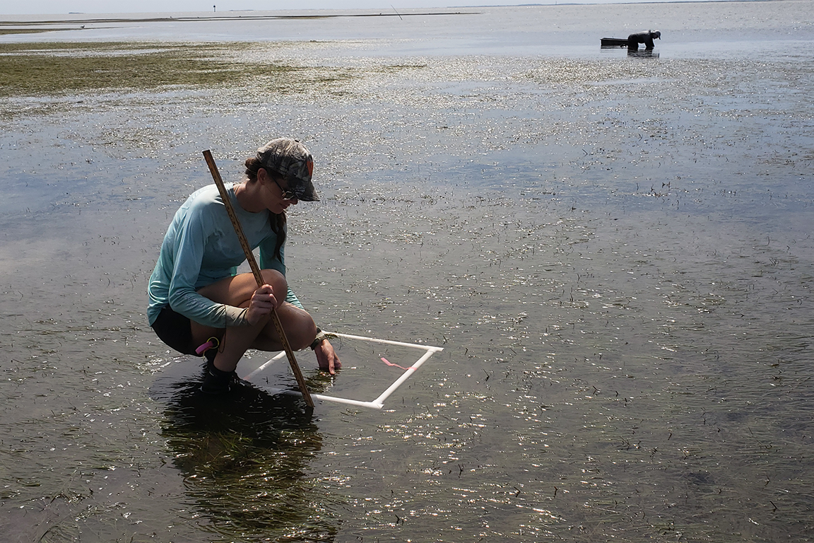
To address challenges in tracking "hidden" SAV in turbid water, and to detect significant trends more quickly (including changes in species composition), APNEP began coordinating a SAV Sentinel Network in 2014. The sentinel network combines boat-based sonar and video technology with in-water observations to track SAV at stations dispersed throughout the sounds. The boat-based protocols were tested on Albemarle Sound in 2014 and the first installment of sentinel stations occurred there in 2015.
APNEP Comprehensive Conservation and Management Plan (CCMP) actions addressed:
- A1.1: Facilitate the mapping of significant ecological, bathymetric, geologic, demographic, and cultural features.
- B 1.1: Refine and implement a submerged aquatic vegetation (SAV) protection and restoration strategy.
- D1.1: Facilitate the development and implementation of an integrated monitoring network through the guidance of regional monitoring and assessment teams.

Learn More
- Submerged Aquatic Vegetation Mirrors Coast's Health (Coastal Review Online, November 2019)
- Biologist: Seagrass A 'Canary in a Coal Mine' (Coastal Review Online, November 2019)
- State-Federal Partnership Monitoring Seagrass Habitats Along NC Coast (Public Radio East, October 2019)
- Underwater Seagrass: NC's Best-Kept Secret for Protecting Shorelines (Public News Service, June 2019)
- Spotlight on Submerged Aquatic Vegetation (2017 Habitat Hotline Atlantic)
- Out of Sight but Not Out of Mind: Understanding the Importance of SAV in the Coastal Waters of North Carolina (Recorded Seminar Talk)