The Albemarle-Pamlico Estuarine System
Many people have heard of or visited the slender ribbon of islands known as the Outer Banks. Unspoiled, sandy beaches summon a steady tide of visitors. Fishing villages, national park lands, and historical lighthouses lure millions of outdoor adventurers. Yet these islands comprise only the eastern edge of a much bigger coastal system with significant ecological connections. Behind the barrier islands are shallow, sprawling sounds, and beyond these waters are freshwater rivers and streams that shape the landscape.
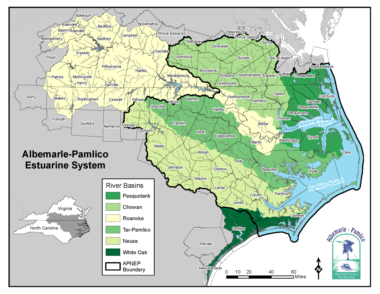
Map of the Albemarle-Pamlico Estuarine System
The entire watershed, or drainage area, of the Albemarle-Pamlico region includes approximately 28,000 square miles of northeastern North Carolina and southeastern Virginia. Nearly 10,000 miles of streams and rivers carve the landscape and pour into an incredibly productive 2-million-acre estuary that is the second largest estuary system in the country. The eastern boundary of the Albemarle-Pamlico region reaches from the southern portion of Virginia Beach to Bogue Inlet near the mouth of the White Oak River. The westernmost edge encompasses most of the Raleigh-Durham metropolitan area. Working according to the ecological boundaries of this watershed, instead of stopping our work at state lines, is part of what makes APNEP unique. The Albemarle-Pamlico estuary was designated as "an estuary of national significance" in 1987, and it continues to be recognized as a nationally important resource through its more recent listing as one of "America's Great Waters." Due to the mixing of nutrients from land and sea, estuaries produce more food per acre than even the richest farmland. Estuaries provide habitat for 75 percent of America's commercial fish catch and between 80 and 90 percent of America's recreational fishing catch. The overall region supports abundant plant and animal life, and is home to nearly 4 million people. It provides generous economic opportunities - farmers cultivate the soils, fishermen ply the waters, loggers harvest forests, and miners unearth minerals. The area also offers residents and visitors alike a wealth of outdoor recreation, from hiking and swimming to hunting, fishing, and boating.
Text Credit: The Albemarle-Pamlico Our Coastal Treasure Brochure, written by Carla Burgess.


