Maps
Are you interested in learning more about the Albemarle-Pamlico estuarine region and its significant resources? If so, you've come to the right place! APNEP and our partners have developed a variety of maps that are helpful for exploring our region.
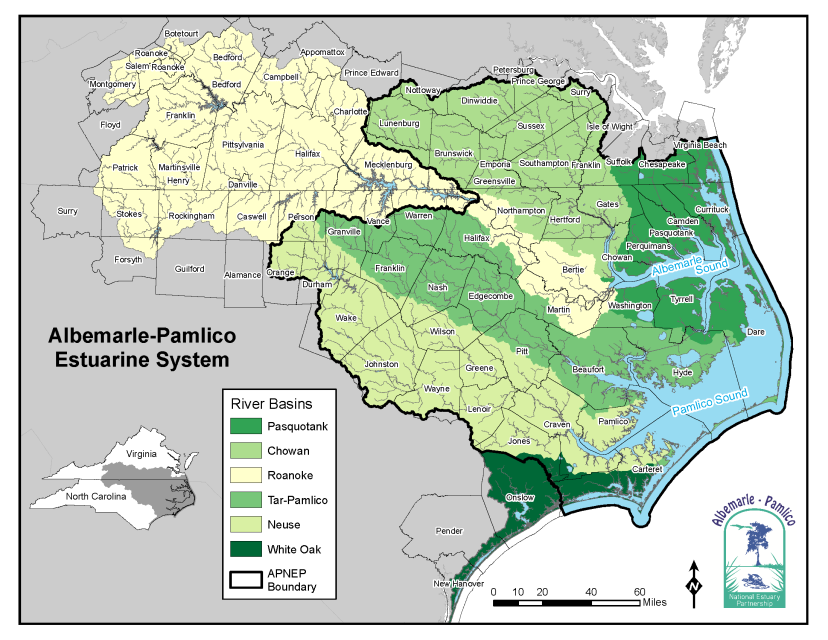

In July 2019, APNEP assisted Virginia-based partners in hosting an educational workshop for teachers based in Virginia's "Southern Watershed," which flows south into North Carolina's Pasquotank River Basin and into Albemarle Sound. APNEP developed a map of the entire bistate "Albemarle Watershed" for use at the workshop and as a lasting resource for educators throughout the North Carolina and Virginia portion of the watershed. Learn more about APNEP's collaborative NC-VA initiatives.
Submerged Aquatic Vegetation Maps
APNEP has coordinated and published two maps of submerged aquatic vegetation in the high-salinity portion of the Albemarle-Pamlico region. Information about how the data was collected, as well as the map data itself, is available on the NC Department of Environmental Quality ArcGIS Online website. Learn more about APNEP's SAV initiatives.